Hiking Trails
Overview
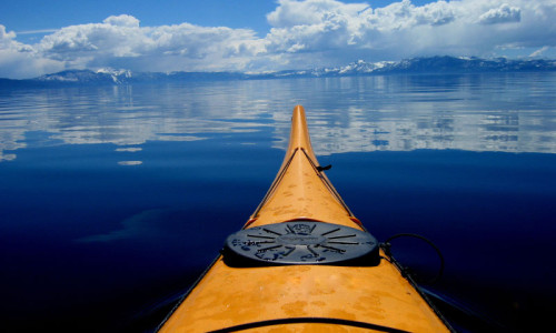
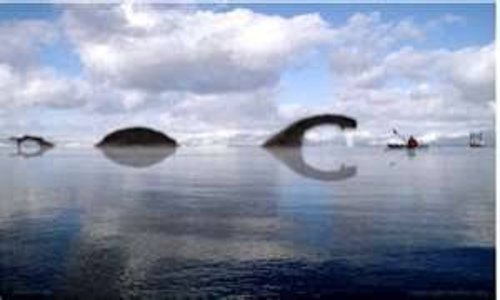
Lake Tahoe, a large, clear freshwater lake (measuring 191 square miles), lies between the northern Sierra Nevada Range and the Carson Range, a spur of the Sierra. Lake Tahoe has long been celebrated as a premier destination for outdoor recreation and relaxation. Below you will find highlights of hikes that provide views of this beautiful lake.
Most hikes on the lake's South Shore (in Desolation Wilderness) require day use permits ($5 fee) that can be obtained at the trailhead. Plenty of water, a compass and map, as well as proper clothing and equipment are always advisable when heading out onto a trail. Weather in the area is prone to rapid, extreme changes. Be prepared!
For more information regarding hikes in the Lake Tahoe Basin contact U. S. Forest Service at (530) 543-2694.
Stateline Lookout Trail (North Shore)
- Trailhead: Driving on Hwy. 89, near CA/NV stateline (NV side), turn north on Reservoir Drive, just east of the old Tahoe Biltmore Casino. Take a right onto Lake View Ave. Turn left onto U.S. Forest Service Road 1601 (look for an iron gate). Park below the fire lookout which marks the trailhead.
- Details: At just over 7000 feet elevation, this 1/2 mile paved loop trail overlooks Crystal Bay and provides, arguably, the best view overlooking Lake Tahoe. Along the trail, there are plaques which offer historical and ecological information about Lake Tahoe. This easy hike is great for kids.
Rubicon Trail
- Trailhead: About 11 miles north of South Lake Tahoe, on Hwy. 89. Look for entrance to D.L. Bliss State Park. Follow road to shoreline, and park in lot beyond the campground. Parking can become quite limited, especially during weekends.
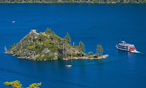
- Details: Heading south from Bliss S.P. trailhead, this shoreline pathway offers spectacular views, the first at Rubicon Point. The trail, which overlooks precipitous cliffs and sandy coves, looks down upon the deepest section of Lake Tahoe. With short sections of moderate incline, the trail continues into Emerald Bay State Park. Roundtrip to Emerald Point clicks in at 6 miles. For those interested in a longer day (9 miles roundtrip, doubling back to your car), the trail leads to Vikingsholm Castle, an estate built in 1929 to replicate medieval Scandanavian architecture. Daily tours available.
- Notes: Much of the trail is shaded by awesome examples of the area's native trees: Jeffrey and ponderosa pines, red and white firs, incense cedar and manzanita. Bring your swimsuit and a picnic! This trail offers coveted beach access. Call D.L. Bliss State Park at (530) 525-7277 for more information.
Eagle FallsTrail
- Trailhead: Located 9 miles north of South Lake Tahoe, CA, on Hwy. 89. Turnoff at Eagle Falls Picnic Area. Limited free parking along highway. $5 fee for parking in lot.
- Details: Located in Desolation Wilderness on the lake's South Shore, this easy hike (2 miles roundtrip) is exceptionally popular. 1/3 mile along trail, hikers approach Upper Eagle Falls, a spectacle reliant upon seasonal water levels. Eagle Lake is picturesquely set in a glacial cirque below Maggie's Peak.
- Notes: To get away from the crowds and continue along on a longer, more challenging hike, set Velma Lakes as your final destination. Day use permits are required from recreation in Desolation Wilderness. Permits can be obtained a self-service stations at trailhead.
Ellis Peak Trail
- Trailhead: From Tahoe City, drive 4.2 miles south on Hwy. 89 to Kaspian picnic area. Take a right at Blackwood Canyon Road. Cross Blackwood Creek and climb Barker Pass, about 7.1 miles to end of pavement. Trailhead on south side of road.
- Details: This moderate hike on Lake Tahoe's east shore provides views of the lake, Granite Chef Wilderness and Hellhole Reservoir. From trailhead, follow switchbacks up to ridgeline (8270 ft.) and continue 1.5 miles. A topo map and compass are highly recommend, as trail splits into spur trails to Ellis Lake and to Knee Ridge and Ellis Peak. Total distance to summit (one way): about 2.5 miles.
- Notes: Contact Truckee Ranger District at (530) 587-3558 for more information. In early spring and into fall, call regarding road closure updates as Blackwood Canyon Road is subject to closures.
Mount Tallac Trail
- Trailhead: From South Lake Tahoe, head north on Hwy. 89 for 3.5 miles. Trailhead sign is located across the road from Baldwin Beach and Taylor Creek Visitor Center. Follow signs for "Tallac Trailhead."
- Details: Prepare for steep grades on this trail which has destination points at Floating Island Lake and Cathedral Lake in addition to the summit (9735 feet). Total elevation gained: 3300 feet. Distance to Cathedral Lake: 2.5 miles (one way). 5 miles to summit. Much of the trail is above timberline and sun and wind exposed. Plan for about 6 hours, round trip.
- Notes: Permit required.
- Sitting at 6225 feet elevation, Lake Tahoe offers hikes of various lengths and grades.
- For information regarding weather and trail conditions, contact U.S. Forest Service in South Lake Tahoe, CA, at (530)543-2649.
- For North Shore views: Stateline Lookout Trail.
- For eastside hiking: Ellis Peak Trail.
- For easy access from South Lake Tahoe: Rubicon, Eagle Falls and Mount Tallac Trails.
Tahoe Adventure Company
Tahoe City, CAOffering unsurpassed family activities including sailing, sea-kayaking, biking and hiking tours on and around Lake Tahoe.